Saturday, September 10, 2011

Our 9/11 Memorial

A few months before the first anniversary of the September 11th attacks Wythougan conceived and funded a simple memorial to commemorate that dark day in American history. The memorial was a simple granite stone positioned between two oak trees. The trees were planted to symbolize the Twin Towers of the World Trade Center; oaks were chosen due to the tree's designation as our National Tree.


The memorial was placed on the south side of Jefferson Street, south of the Marshall County Courthouse. When the miniature Statue of Liberty was restored on the courthouse lawn, the granite September 11th memorial stone was relocated to the feet of Lady Liberty. The symbolic oaks are still thriving. While Wythougan always strives to preserve the reminders of our past, there are times when commemorating moments of our recent collective past are important also.


September 11th. Marshall County remembers.

Tuesday, June 28, 2011

Summer Program Schedule


Wythougan’s 2011 Program Schedule for Jacoby Church & Summit School

July 10 at 2:00 p.m. Vocal music by Melody Makers
Jacoby Church

July 24 at 2:00 p.m. Marshall County Church Orchestra
Jacoby Church

Aug. 14 at 2:00 p.m. Music by Dave Haycraft
Jacoby Church

Aug. 28 at 2:00 p.m. Old Fashioned Hymn Sing
Jacoby Church

Sept. 11 at 2:00 p.m. Civil War Remembrance
Jacoby Church Historical interpretations
Letters from Soldiers
Period music by Jack & Dawn Roose
Period Refreshments

Sept. 25 at 7:00 p.m. Wildflowers of Indiana
Summit Chapel by Laura Snipes

Oct. 9 at 2:00 p.m. Harvest Gathering
Summit Chapel Memories of Summit School
Symbolism of Grave Markers
Special Music by Autumn Leeds

Oct. 15 at 5:00 p.m. Wythougan Annual Meeting
Bremen Depot

Monday, June 20, 2011

Jacoby Church turns 150

The 150th anniversary of the original dedication of the Jacoby Church on King Road was held on June 12, 2011. A stirring message was delivered by Bob Read, who grew up in the church, and the Maxinkuckee Singers provided inspirational music.


The following is a history of the Jacoby Church:
In 1847 a group of German families from Ohio settled together in what would become known as the Jacoby Neighborhood. After losing their daughter Catherine to typhoid fever in 1850, John & Catherine Jacoby deeded a parcel of land for the purpose of a cemetery, church, and school. John Fesser began construction in 1860 on the one room Greek Revival style church building. On May 23, 1861 the Plymouth Democrat reported that the German Reformed Church situated three miles east of Plymouth in the Jacoby neighborhood will be dedicated on June 9, 1861.
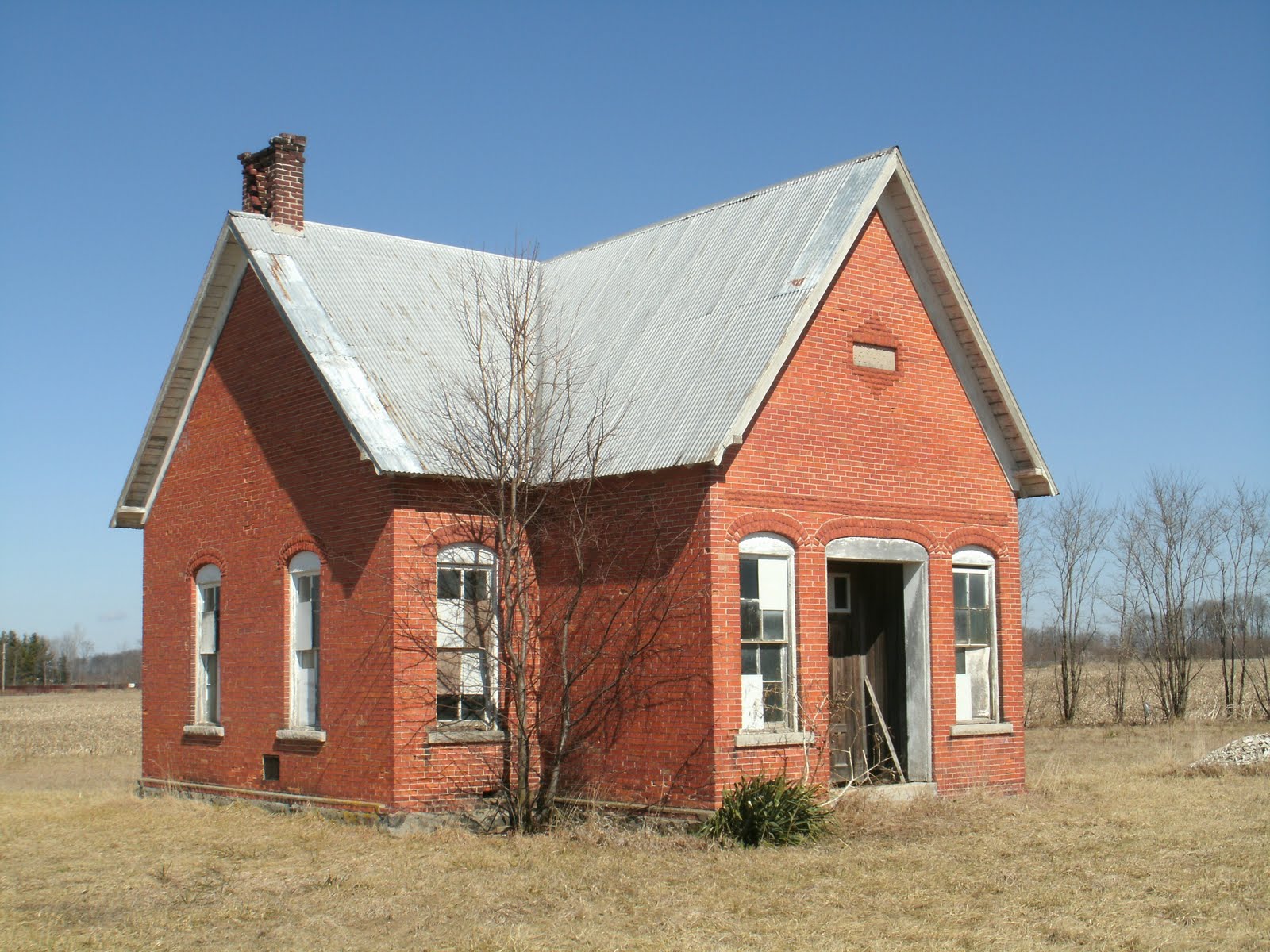
Jacoby Church operated for the German Reformed and Lutheran Denominations (1850), German Reform Church (1861), St. John’s Church (1870), and St. John’s Reformed Church of Center Township (1892). According to the Daily Pilot on Sunday April 7, 1935 the Maple Grove and Jacoby Sunday School honored John R. Jacoby, Jr. for serving 54 years as a faithful janitor and sexton of the church. During the 1940’s a congregation formed with ties to the Missionary Church denomination, through Bethel College. On June 29, 1958, the Jacoby Church reopened after being closed for many years by the congregation that would later build Sunrise Chapel. Services were held here until April 26, 1964 when their new church was constructed east of Plymouth. Iris Price, a Jacoby descendant, coordinated maintenance for the structure and cemetery for many years after. A one room school house was once located north of the building.

The building is a combination hand-hewn timber frame and balloon frame construction. The floor timbers are oak and poplar logs 24” wide. The roof has unusual hewn timber frame trusses. While most of the interior finishes date to 1910 when the building was remodeled and the foyer and bell tower were added, the unusual wood ceiling was exposed during restoration and dates to 1860. This type of ceiling exists in only one other known location in Indiana. The oil lamps hanging from the walls are original, as are the wood slab benches and wood stoves. The pews, podium, alter, and hymn and attendance boards date to the 1910 remodel as does the piano.


In 2006 Wythougan Valley Preservation Council worked with Center Township Trustee Doug Kucera to restore the building. Restoration was completed in 2008 using more than $40,000 in cash and volunteer services. The building was placed on the National Register of Historic Places in 2006.

Wednesday, June 8, 2011

Jacoby Church 150th


The rededication service is scheduled for Jacoby Church, one mile north of US 30 on King Road, for Sunday, June 12 at 2:00 pm. The event will mark the 150th anniversary of the original dedication on June 9, 1861.

The Maxinkuckee Singers will perform and lead in singing hymns. Mr. Robert Read, who attended the building as a child, will provide an inspirational message. Light refreshments will be served.

Because parking is at a premium, please consider carpooling with others you may know who would enjoy attending this event.

A history on the building can be found at:
http://hoosierhappenings.blogspot.com/search?q=jacoby+church


We look forward to marking this important milestone of Marshall County's oldest public building with you.

Monday, May 23, 2011

Plymouth: Bridge City

Part 2 in the series on Plymouth's historic bridges

The second phase of bridge construction employed new technology developed at the close of the 19th Century. Concrete cast into arched forms provided a modern approach to traversing the Yellow River.


Jefferson Street/Lincoln Highway Bridge, 1927
Type: Filled-spandrel two-arch; skewed. In 1987 a cantilevered deck was installed and the project removed rails and lampposts. The original engineer is unknown.
The new alignment’s path (1928) of the Lincoln Highway in Indiana was fully decided except for the path it would take through the City of Plymouth. There were two sides lobbying for their own path the highway would take. Ultimately the state told Marshall County if they could not decide, it would be decided for them and a deadline was given. Several meetings followed until the night before the deadline and in packed chambers at the high school, both sides presented their case for their preferred path. The two choices were between the downtown, using Pennsylvania Avenue, or Jefferson Street. The City and downtown businessmen lobbied for the downtown route, while others preferred Jefferson Street. If the Jefferson Street route was chosen, a new bridge would have to be constructed over the Yellow River. If the downtown route was chosen, the highway could use the new Garro Street Bridge. Ultimately the group promoting the use of Jefferson Street won because they were able to show that even with the construction of a new bridge, their path would be less expensive to construct. The new Jefferson Street/Lincoln Highway Bridge was constructed between 1927-1928 for the sole purpose of the new alignment of the Lincoln Highway.
Garro Street Bridge, 1919
Type: Filled spandrel two-arch; skewed with triangular cutwater and paneled pier pilaster, National Concrete Company, builders
The concrete bridge was constructed at the river crossing of one of Plymouth’s most important cross streets. It retains significant integrity despite the loss of its ornate streetlights mounted at each corner. Arched concrete bridges of this period were constructed using wood planks as the underside of the bridge form. The plank and wood grain marks can still be seen in the concrete under the arches.

Michigan Street Bridge, 1917
Type: Filled spandrel two-arch; Daniel Luten, engineer
The bridge forms the southern terminus of the Plymouth Downtown Historic District, listed on the National Register of Historic Places in 1998. The bridge was restored in 2007 with handrails sympathetic to the original design with the added feature of lampposts in the style of the historic residential areas of Michigan Street. Daniel Luten was a world-renown concrete bridge engineer and created some of the most spectacular spans in the United States. He taught engineering at Purdue University. The current bridge replaced an early steel truss bridge; the original drawings for the steel bridge are located at the Marshall County Museum. The Marshall County Commissioners restored the bridge in 2007.

Sunday, May 15, 2011

Plymouth: Bridge City

Part 1 of a 2 part series on the Historic Bridges of Plymouth
Most people wouldn't think of Plymouth as a city of bridges, but indeed with the meandering nature of the Yellow River and the route of the former Pennsylvania Railroad through the city, bridges were a very important part of a transportation plan even when the city was a mere town of a few thousand souls. There are six historic bridges in the City of Plymouth, three are steel and date to an earlier period of time, the other three are concrete. The following are those fabricated in steel:


LaPorte Street Footbridge, 1898
Type: Steel suspension bridge, Rochester Bridge Company, builder
The bridge was listed on the National Register of Historic Places and is one of only three historic footbridges in the State of Indiana. All three are suspension bridges, meaning that the deck, or walkway, is suspended by cabling to the end piers. The other two bridges are newer and were part of the New Deal projects in Turkey Run State Park and Winamac. The Rochester Bridge Company operated out of Rochester, Indiana and was a prolific bridge fabrication plant for the Midwest.


Pennsylvania Railroad Viaduct, c. 1900
Type: Pony plate girder truss with two spans on rusticated limestone abutments and center pier. About 1995 the railroad covered the center pier with concrete.
When the Pennsylvania Railroad first came through Northern Indiana in 1856 its route through Plymouth crossed the historic Michigan Road with little problem. But as Michigan Street became more traveled it is believed the railroad created an earlier viaduct which then was expanded in about 1900 to accommodate two sets of tracks. Close examination of the stone abutments show various symbols indicating to builders how to construct the abutments, as well as the difference between the earlier stone used for the original abutment and the 1900 construction.


Pennsylvania Railroad Bridge, 1902
Type: Eight panel full-hip Pratt pony truss style metal bridge on rusticated limestone abutments, American Bridge Company of New York, builder
In James Cooper’s Historic Metal Bridge Inventory, it states this bridge is among the earliest examples of the Pratt pony span built on Indiana’s rail system that still exists and references the heavy members designed for unusual load-bearing capabilities. As part of the city’s greenway plans a canoe portage will be located below the bridge on the sandy shore of the Yellow River. James Cooper is a professor at Ball State University and is considered the leading authority on Indiana bridges.

Monday, May 9, 2011

Bremen Depot Rededicated


This is the last in a series about the Bremen B&O Depot that was rededicated on May 1st under sunny skies with the Bremen Band playing to a crowd of over 120 well-wishers.

The Bremen depot was located on one of several historical railroads in Marshall County. These include the Pennsylvania Railroad (or Pittsburg-Ft. Wayne-Chicago) that runs east/west through the center of the county through the communities of Bourbon, Inwood, Plymouth, and Donaldson. The Vandalia Railroad and the former Nickel Plate Railroad (or Lake Erie-Western) also were located in the county and essentially ran north/south through the communities of Argos, Plymouth, and Tyner (Nickel Plate) and Culver, Plymouth, and LaPaz (Vandalia). Another east/west railroad (New York-Chicago-St. Louis) is located in the southern part of the county and goes through the communities of Tippecanoe, Argos, and Burr Oak. The railroad also went through a number of small railroad villages that never developed full railroad stations.

Bremen’s depot is one of only four train depots that remain in Marshall County. The Pennsylvania Station and Nickel Plate Depot both exist in Plymouth. The Pennsylvania Station is a brick building constructed in 1914 and the Nickel Plate Depot was constructed in 1889 in the Stick Style. Both of these buildings are used for railroad storage and unfortunately are in deteriorating condition. Culver’s Vandalia Railroad Station was constructed in about 1925. It has been converted to a meeting hall for the Culver Lions organization. The other county’s depots, most of them small wooden structures, have been demolished.

In 1914 there were 123 depots on the three B&O lines through Indiana; the number had dropped to 27 by 1986. About the same time there were only 11 depots remaining on the Chicago (Bremen) line of the B&O. The B&O Railroad constructed wood depots in LaPaz and Teegarden west of Bremen in Marshall County; these no longer exist. West of Marshall County the B&O Railroad constructed wood depots in Walkerton, Miller and other smaller communities prior to the rails’ junction with the Grand Trunk leading into Chicago. Only the Miller depot, constructed in 1910, exists; it has been renovated and is in use as a restaurant. Gary’s Union Station, a large Classical Revival building, was constructed by the B&O in 1910 and remains today.

East of Bremen the Baltimore & Ohio Railroad constructed a depot in Nappanee in 1910 and remains an active passenger station. East of Nappanee the next B&O town was Syracuse. It retains its historic depot that was constructed in 1913 in much the same style as Nappanee’s depot; it is in deteriorating condition. East of Syracuse a wood depot was constructed in Wawasee in 1908; it was relocated to Benton, IN. East of Wawasee only two other B&O depots remain in Indiana. One is in Garrett, a town founded by the Baltimore & Ohio Railroad and named for its president; the building is the railroad’s freight depot constructed as a simple side gabled building in about 1910. The other is the Auburn Junction Depot that was constructed about the time the B&O Railroad was constructed through Indiana, in 1874. It was built in the Italianate style and relocated from its original site. Most of the remaining B&O depots in Indiana date to the infrastructure improvements between 1910 and 1917; Bremen’s construction in 1929 came considerably later.


Many congratulations to the folks in Bremen and with Historic Bremen, Inc. for the restoration of yet another Marshall County landmark.

Saturday, April 30, 2011

Bremen Depot: part II


Second in a series on the Bremen Depot in celebration for its rededication Sunday, May 1st.


Having a new depot constructed by the railroad was termed a “long dream” by the town when a committee of business men met with high officials of the railroad in 1928. By the end of this meeting railroad officials had given their “unqualified assurance” that the company would build a new depot that would be considered “modern and adequate”. Work would start as soon as plans presented by the railroad were modified based upon suggestions by the committee at the meeting. The plans presented by the railroad appear to have been proposed to the town prior to the meeting and were referred to as “original plans of several years ago”. It is unclear why the railroad had not constructed the depot prior to this time. The original drawing of the depot as proposed by the railroad was virtually identical to what was constructed with the exception of porticos constructed on each side over the entries.

It appears that the town of Bremen requested the addition of the porticos, probably for the purpose of sheltering passengers entering and exiting the building. No doubt the town also adhered to the thought proposed by Clay Lancaster in his book Waiting for the 5:05: Terminal, Station and Depot in America, “The train station was the image of the community, presenting at a glance something about its size, affluence, livelihood and social range of its citizens, their taste in architecture.” It appears the townspeople took image seriously when the portico additions were made to the original drawings. A newspaper article stated that the new depot would compare favorably with anything else located on the rail line. The appearance of the building was positively commented on in succeeding newspaper articles as well as its superior and virtually fire-proof construction. A review of other buildings constructed in the community at the time of the depot’s design and construction shows only one in a comparative style and level of detail found in the depot. If the committee of business men were looking for a visual precedent from which to draw inspiration for the addition of the porticos the bank building at the southwest corner of Plymouth and Center Streets may have provided this. It was constructed only a few years previously in a neoclassical design with fluted columns flanking the front entry. It was restored and now serves as the town hall.

There has been no success in making a determination of who designed the depot. The name R Ramsay Smith with a copyright mark is located on the original rendering of the depot prior to the inclusion of porticos (1928); however Smith may have only been responsible for the rendering. In an article written about the dedication of the depot RF Everet was listed as one of the railroad officials, and as the Building Engineer located out of the B&O Railroad’s Garrett office. However, it is indeterminate if Everet was the design engineer or a supervising engineer for the railroad. During the period in which the Bremen depot was redesigned and constructed the B&O Railroad’s Chief Engineer was HA Lane, their Engineer of Building was LP Kimball, and their Engineer of Construction was AM Kinsman. The B&O Railroad used the term “Engineer of Buildings” for the head of their design division, but it is indeterminate if Kimball designed the Bremen depot, though he has been credited with the design of other depots. Both Lane and Kimball are referenced in these positions as early as 1922 and Kinsman as early as 1905.

Construction began on the new passenger depot in April, 1929 by a local contractor, S. G. Lehr; the old depot was to be used as a freight house. The new depot was dedicated on October 22, 1929. The dedication was a formal event with high-ranking representatives from the Baltimore and Ohio Railroad, local officials, and American Radiator officials. The Bremen Kiwanis Club organized the event that included a brief tour of the town, speeches, music, and a banquet at the Arco Hotel. The depot’s use followed the declining use of the railroad as the automobile became the preferred method of transportation. The new depot served the town for forty years with passenger service until it ceased in 1971 and was used only as a railroad office. That use ended in 1987 with the transfer of the railroad’s last station manager from this location, Melvere Sheley. The Baltimore & Ohio Railroad retained its identity until 1986; the railroad through Bremen is an active line currently operated by CSX.

Saturday, April 23, 2011

The Bremen Depot


Part 1 of a 3 part series celebrating the Bremen Depot restoration & rededication to be held on May 1st. Congratulations Historic Bremen!


Baltimore & Ohio Railroad History
The Baltimore and Ohio Railroad is the oldest mainline railroad in the United States. It traces its history to a committee of business men assembled at a Baltimore, Maryland residence in 1827. The men assembled weighed the options of canals, turnpikes, and railroads as the best means to open the city to markets in the developing western states by way of the Ohio River. It was established that a railroad was far more cost-effective than the construction of a canal, and that Baltimore had a considerable advantage since it was closer to the Ohio River than either Philadelphia or New York City. The committee requested a charter for a stock company to be known as the Baltimore and Ohio Railroad from the Maryland legislature in the same year. The legislature granted the charter with a capital stock of $3 million dollars. A survey for the route was undertaken in 1827 and in great fanfare a cornerstone was laid by Charles Carroll, the last surviving signer of the Declaration of Independence, to initiate the construction of the railroad on July 4, 1828.

After the Baltimore & Ohio Railroad reached the Ohio River, it began to set its sights further west which ultimately would include three routes through Indiana. The first two routes were constructed through southern and central Indiana in 1857 and 1852, respectively. The Civil War interrupted additional construction on the railroad, but demonstrated the importance of having a functioning system of rails as a national supply route. John W. Garrett, president of the B&O Railroad, immediately set plans into place following the end of the war to reach more markets with the railroad. Garrett eyed Chicago as an important destination for markets on the east to reach and commenced the construction of the B&O Railroad through northern Indiana from Pittsburg west to Chicago, becoming known as the Baltimore, Pittsburg, Chicago Railroad, in 1871. By the fall of 1872 a 260 mile grade had been established from a point on the Lake Erie Division ninety miles north of Newark west to Chicago. During 1873 most of the track had been laid between Chicago Junction on the Lake Erie Division and Deshler, Ohio, 63 miles to the west. The remaining 200 miles of track was laid between Deshler and Baltimore Junction, Illinois in 1874. The final track was laid on November 15, 1874 and the line was officially open for traffic on November 23. B&O passenger trains used the Illinois Central line coming into Chicago while freight trains used the Eastern Trunk line. The first year of operation showed revenue at nearly $1 million dollars and a deficit of $126,000. However the following year net earnings reach $167,000.

The northern route of the Baltimore & Ohio Railroad passed through Bremen on the north side of the town approximately three blocks from the original plat of Bremen between the town and its burial ground. The main street of Bremen (today SR 106) was an east/west street named Plymouth Street that was crossed at the center of the downtown by “Center Street”. Center Street connected the downtown with the railroad, industrial grounds, and the burial ground on the north side of town via a bridge constructed over a fork in the Yellow River. The railroad was located just north of the river, paralleling it for a short distance before it crossed the river west of Center Street, paralleling it again but on its south side. The depot grounds were established by the railroad on each side of Center Street, north of the track. The railroad originally constructed a simple wood framed depot on the west side of Center Street and north of the track; it acted as a passenger station, freight office and Western Union office. Two streets west of the original plat were named in honor of the railroad’s origin: Baltimore and Maryland Streets.

The 1908 plat map of the town shows the importance of the railroad to the development of the community. New plats were created north of the railroad along Center Street. Huff’s Addition with “Railroad Street” was created north of the depot on the west side of Center Street and “Manufactures Addition” was created on the east side of Center Street, north of the radiator company. The depot grounds on the east side of Center Street had considerably more development including an elevated wood water tank and tool house. A rail spur also connected a grain elevator, stock pens, and pickle shed on the east grounds as shown in the 1908 plat of the town. The same plat shows a spur connecting the Holland Radiator Company north of the elevator with a coke and sand shed and warehouse located between the two. A second elevator was located on the west side of Center Street, north of the depot. Another short spur connected a brewing company to the track in the northwest corner of the town.

The 1922 plat of the town shows little change in the buildings on the depot grounds, but considerably more development of the radiator company, then called “American Radiator Company”. The plant appears significantly larger in footprint than in 1908 and had two other spurs entering the building. The company was also named in the creation of a re-plat of a portion of Manufactures Addition north of the company and had constructed its own hotel north of the depot named the “Arco Hotel”. The 1922 plat also shows an engineered realignment of the fork of the Yellow River, now called Armey Ditch (also written Army), which provided more land between the south side of the railroad and the ditch on each side of Center Street. The railroad took advantage of this in 1929 when it replaced the original depot on the north side of the track with a new depot between the ditch and the south side of the railroad on the same side of Center Street.

A wave of new infrastructure improvements by the B&O Railroad resulted in several new depots constructed along its lines between 1910 and 1917; these included new depots designed in period styles located in Nappanee, Syracuse, and a large depot in Gary. However Bremen, a town similar in size to Syracuse and Nappanee, was not included in these improvements and maintained its original wood, rather non-descript depot.

Saturday, April 16, 2011

Barber School Part II

Part 2 of a series on the Barber School, Polk Township
In 1840 Marshall County had forty school-age children, twenty-five of whom attended subscription schools. There were only three schoolhouses in the county at that time. In 1848 the State of Indiana allowed voters to decide if education should be made available free to the public. Marshall County residents voted 619 in favor and 86 against. The state constitution was amended to include Article VIII providing for tax dollars to be used for the free education of the public’s children. After its adoption rural schools began to develop rapidly in Marshall County, keeping pace with the settlement of the area. By 1858 the number of schoolhouses had grown from 3 in 1840 to 69. In 1862 there were 84 schools, in 1868 there were 116 schools, and by 1879 there were 132. The total enumeration had grown from 3,880 students in 1856 to 8,386 in 1879. Districts schools were typically positioned to allow students to not need to walk any further than about one mile, and they were frequently on land donated by a farming family under the condition the land would revert back to the family if there was no longer school conducted on the land.


An 1850 map of the school district lines in Polk Township shows a total of nine districts. In 1852 Stephen Butler conveyed a piece of land in the northwest corner of section 33 for use as a school site in District No. 2, Polk Township. Butler included a provision that the building could be used by Methodists, United Brethren, Baptists, Carmelites, Presbyterians, Universalists, and religious uses, and should it ever stop being used for school purposes it would revert back to him. Other records state that the first schoolhouse, made of logs, was constructed on the Joshua Barber farm in the 1850s. It was located near the center of Section 33 at its northern boundary (on the southeast corner of present U.S 6 and Sage Road). This may be the same building. In 1864 the trustee ordered the construction of a new frame building which remained in the same general location on the Barber farm. The “Barber School” remained at this location until the new school was constructed southwest of it in 1901. The prior schoolhouses no longer exist. The frame building was listed as District No. 2 Schoolhouse on an 1880 plat of the township and located on the Albert Barber farm. The building also appears at this location in the 1872 and 1876 plats; it was also used as a church and community hall for debates, literary purposes, and spelling bees. By 1880 Polk Township had developed ten district schools with a total value of $3,300. The number of school districts increased to twelve by 1887, then back to ten just prior to school consolidation. Statistics from 1880 show there were 490 students enrolled in the district schools of Polk Township. The Barber School hosted the first grade school commencement in 1887. It was coordinated by township trustee Myron Chase and cost $2.00 to conduct. Joshua Barber became a school teacher in the township system of schools.


The Walkerton Independent stated in 1901 that (Polk Township) Trustee (Edwin R.) Monroe was contemplating building a new school house in the Barber settlement on Wesley Ruple’s farm near his residence, with the patron’s consent. Plans for the new building moved forward and Monroe revealed the bids taken to the Walkerton Independent. Frank Bennett received the contract for carpentry work for $114.50. Laying of brick was awarded to H. P. Mead at $6.50 per cord and stone masonry and plastering were awarded to Joe Burnside for $3 per cord (stone) and 7 cents per square yard (plaster). Two bids for building the school completely were rejected; they were for the sums of $1,390 and $1,196. The new building was completed about five weeks into the new school year with classes commencing on November 11, 1901. The new District No. 2 school retained the Barber name but was located at the northeast corner of Tamarack and 2A Roads, southwest of the former location; the old school was sold at public auction to Sanford Sheaks for $41.00. The new school appears on the 1908 and 1922 plats of Polk Township. A photograph from about 1908-1910 shows 27 students gathered outside the school with their teacher, Homer Burke. A photo from 1920 shows 17 students gathered in front of the building with their teacher, Carl Ketchum.


The desire to have modern utilities for school facilities, such as gas and electric, led to the establishment of consolidated schools in population centers. There was also an increased desire to provide higher grades than what was offered in the rural district schools. This was true in Polk Township where the first high school was located in Tyner in 1899, with the first graduating class, with 10 graduates, occurring in 1902. The Tyner School had expansions in 1912 and 1928 to accommodate consolidation. A school was also constructed in Teegarden in 1915 to accommodate the closure of District Schools #1 through #4, which included the Barber School, though evidence suggests the Barber School continued to be used into the early 1920s. The new Teegarden School burned in 1924 and it was replaced with a grade school only in 1925. Upper grades were offered at the Tyner and Walkerton Schools. After the use of the Barber School ceased for education, evidence suggests that the building was used for storage of grain or other agricultural purposes by the farmer who reclaimed ownership. Today the Barber School stands as a quiet reminder of those one room schoolhouse days complete with coat hooks and wood shelves for lunch pails. It is probably the finest little one room schoolhouse remaining in Marshall County.

Tuesday, April 12, 2011

the Barber School


Part 1 of a 2 part series on Polk Township District No. 2 school house, also known as the Barber School. The Barber School has been on Wythougan's Top 20 Heritage Sites List since its inception in 2000.


The Barber Family, the name associated with the school, came to Polk Township in 1847, just two years after its incorporation. Joshua T. Barber was born March 26, 1810 in Washington County, New York where later he married Mary O’Dell. They moved with their first four children to Marshall County via the Erie Canal, then overland through Ohio. He filed his land claim in Section 33 of Polk Township in 1848. The name is also spelled Barbour and Barbur in some records. The four children who accompanied them on the move were Charles (Leonora Strom), John (Emily Myers), Ann Eliza (Izaak Sheeks), and Albert (Sarah Reynolds). Three additional children were born to Joshua and Mary in Marshall County; they were Julia Catherine (Davis), and twins Delia (Carder), and Daniel (Mary Martin). The Barber homestead was located on Sage Road, south of present U.S. 6.


The area they settled became known as the “Barber Neighborhood” and a family cemetery and a Brethren church were established on 2A Road, just south of the original Barber School location and just east of the current District No. 2 Schoolhouse. The condition of the Barber Neighborhood in 1858 was described as almost a wilderness, with no drainage, and no established roads or railroads, and the settlers had to raise their crops among stumps. The Barber Cemetery was established in 1870 for the use of farming families; the first interment was Macelia Ramsbey, a child who died in 1867. The church was known as the Barber Evangelical United Brethren Church; it was constructed in 1878 and was closed in 1923. The church is no longer existing, but the Barber Cemetery remains an active burial ground. Joshua Barber died in 1874 and Mary died in 1878; both are buried at the family cemetery. Over a dozen members of the Barber family are buried in the cemetery spanning several generations including several of Joshua’s children.


Besides the Barber School only one other district school remains in Polk Township. It is the District No. 8 School that was constructed in 1895 on West 1st Road, approximately one mile northeast of the District No. 2 School. It is a brick building that is nearly identical to the District No. 2 School in terms of its T-plan configuration. It is plausible both schools were constructed by the same contractor given their similarities, proximity, and frequent occurrence of this practice in townships. The two larger schools in Polk Township into which the District Schools were consolidated were the Tyner and Teegarden Schools. The Tyner School was constructed in about 1900 and was enlarged in 1912 and in 1928 to accommodate consolidation. The Teegarden School was constructed in 1925 also to accommodate consolidation. Both consolidated schools have been razed.

Saturday, April 2, 2011

Bremen Water Tower, part 2


An article in the Bremen Enquirer on October 21, 1892 celebrated the new water works completed by the town which included the historic "standpipe". Touting the town’s progressive approach to public water service the article headline states “Bremen sends greetings to her sister towns with the injunction-Go and Do Likewise”. The only other Marshall County community with a public water system at that time was Plymouth, the county seat, who had established a system in 1888. Discussions for the Bremen system began early in 1891 and townspeople were invited to vote to show their support for the system. An overwhelming majority voted in favor of a public water system and the town board pursued the development of engineering drawings.


The project included an engine house which was constructed on the east side of North Center Street, just south of the fork of the Yellow River. The land was purchased from E. J. Thompson and was “cleared of all rubbish, filled up and beautified so that it will make a fine park in a few years.” The work on the ground was completed by John Foltz, who became the water works engineer. This land became a park in the early part of the 20th century and today is known as Shadyside Park. The engine house was a simple gable-front building constructed out of wood with Stick-style eave brackets and decorative trusses in the gables. A tall smokestack was located in the roof’s ridge. James Madden is listed as the contractor; however Samuel Lebr, George Shock, and John Bixler are credited with the carpentry work. Painting of the building was completed by C. E. Koontz and H. A. Place. The building was called “beautiful” and its workmanship “first class in every respect”. The supply of water was generated from pumps connected to seven artesian wells without the use of cisterns for storage. The boiler in the engine house was supplied by Madden with the inscription “Bremen Water Works, James Madden Contractor, Fort Wayne, Indiana, 1892”. The engine house was replaced with a new electrical powerhouse in 1937. It was a Works Progress Administration project and is located at 123 East Mill Street, just north of the former location. That building is still in use by the town. The standpipe was constructed on South Jackson Street, approximately three blocks north and one block west of the engine house near the center of the historic commercial district. The standpipe was designed with some embellishments that include Gothic arched doorway and window openings and a decorative railing crowning the top of the tank. The brick for the tower’s base came from Nappanee and the masonry work was completed by masons from Goshen and Nappanee.


The newspaper article celebrating the completion of the water works described the extension of the pipe line along the town’s principle streets and hydrants being placed so that with the amount of fire hose the town owns any house can be reached in case of fire. The water works were put into operation on August 11th and at the time of the article on October 21, 1892 over 100 people were being served. It was estimated within another year’s time every house would be connected to the system. The article predicts that the water works would attract strangers to the community and a new era of prosperity would be opened for the community. The construction of the radiator manufacturing facility north of the railroad tracks was touted as a direct benefit of the new water works system.


A new water tank on the west side of the town was put into service in 1956; however the historic standpipe had become a landmark for the community and was left intact. In 1975 the standpipe was named an American Historic Water Landmark and between 1988 and 1989 the Town of Bremen fully restored the structure. The standpipe’s image is continually used by community organizations and the municipality as an icon for the Town of Bremen.

Saturday, March 26, 2011

Bremen Water Tower


Part 1 of a 2 part series on the Historic Bremen Standpipe

The Bremen Water Tower, historically known as “the standpipe” is an unusually well-preserved example of a structure supporting early municipal services, in this case public water. The standpipe has a tall slender brick base 68' tall crafted with Gothic Revival details that supports a tall slender steel tank, 36' tall. The tower was constructed in 1892 and was taken out of service by the community in 1955. Though removed from service, it has become a beloved community icon and was named an American Historic Water Landmark in 1975. It was fully restored between the years 1988 and 1989.

The town of Bremen by the late 1800s was developing with the growing need for a better public water system. The town contracted with an accomplished engineer from Chicago for the design of new water works station and standpipe. George C. Morgan engineered the system and James D. Madden, a Fort Wayne contractor, constructed the facilities. Neither Morgan nor Madden were unfamiliar with public works projects.

George Cadogan Morgan was an accomplished engineer specializing in water hydraulic developments for municipalities. Morgan was a member of a family involved in early American engineering and surveying, particularly related to the railroads; his father was Richard Price Morgan. George C. Morgan was a master mechanic for the Fort Wayne-Chicago Railroad and was responsible for the construction of water tanks along the route. Morgan came to Chicago during the 1860s and worked on the city’s first iron bridge, the 18th Street Bridge, in 1868. He is found in the 1876 Chicago city directory under George C. Morgan, civil engineer. His office was located in the Major Block and his residence was at 389 West Adams Street. Morgan was best known for his development of municipal water works in small towns throughout the Midwest which included steel standpipe construction for the public reservoir of water.

Morgan’s water works throughout the Midwest was extensive. A review of available sources, primarily various issues of Engineering News and the Manual of American water works, show 34 Morgan-designed standpipe water works systems between 1888 and about 1907, including Bremen’s constructed in 1892. These were located primarily in Illinois, but also in Michigan, Iowa, Louisiana, New York, Indiana, Missouri, Tennessee, and Kentucky. In a few locations the standpipe is called “a Morgan’s Tower” or “Morgan Special”; whether officially or informally in the minds of the public Morgan had trademarked his standpipe design. In Indiana Morgan designed standpipes in Shelbyville, Delphi, Fulton, Rockville, Bremen, and Bloomfield. The first references found regarding Morgan’s standpipe design is in 1888 with tower construction in Washington and Hoopeston, Illinois. Morgan designed Bremen’s standpipe to have a 68’ brick base with a 12’ x 36’ tall steel water tank. This general design seemed to be popular and easily adapted for other municipal systems. The most similarly sized standpipes were in Delphi, Indiana (11 ½’ x 36’ tall tank on a brick base, constructed in 1891-92) and Hoopeston, Illinois (10’ x 36’ tall tank and a 68’ brick base, constructed in 1888). Several other standpipes were also constructed on 68’ bases but had 48’ tall tanks; these were found in Lexington, Farmer City, Macomb, Grinnell, Monticello, Galva, Illinois and Indianola, Iowa. A standpipe in Caruthersville, MO, listed on the National Register of Historic Places in 1982, has a strong resemblance to Bremen’s including the Gothic arched openings in its brick base and decorative metal railing at the top of the tank; it was constructed in 1902.

Illness forced Morgan’s retirement in 1900 though some of his work is found a few years after this date. His wife passed away in 1900, but he remained at his 389 West Adams Street residence and died in 1913. His nephew, Arthur Marshall Morgan, who had joined his uncle in his practice in 1881, continued the business.

James D Madden was born in 1856 in County Derry, Ireland and came to the United States at seventeen years of age. He apprenticed in Philadelphia with a firm named Hoolihan & Barry for five years until 1878 when he opened his own shop in Philadelphia. Two years later he moved to Fort Wayne, Indiana and began his plumber’s trade in that city. An 1889 history described Madden as a prominent plumber and the proprietor of a handsome plumbing establishment at 101 Calhoun Street. The biographical information on Madden found in a Bremen Enquirer article concerning the newly constructed water works varies slightly. It stated that upon arriving in America Madden first engaged in the plumbing and water works business under the firm of Ludlow & Co. in Philadelphia and in 1876 was named Superintendant of the York, PA water works. The article states that he moved to Fort Wayne in 1880 and established his business in 1885. Madden constructed his first water works plant at the Eastern Insane Hospital of Indiana in 1889. He constructed the state plant in Fort Wayne, and plants in North and South Evanston, Illinois. Madden also constructed the water tower in Nappanee in 1893. The tower consisted of a tank 24’ x 20’ tall on a tower 70’ tall, all constructed out of yellow pine. The engineer for that design was Fairbanks, Morse, & Co., of Chicago. Madden and Morgan apparently competed for contracts on the construction of water works at least in one occurrence. A water works development in Hinsdale, Illinois had received bids from GC Morgan of Chicago in the amount of $33,908 and from James Madden of Ft. Wayne in the amount of $36,450.

Saturday, March 19, 2011

The First Decade of Wythougan

The Garn House, Wythougan's first project in 1999

When Wythougan celebrated its tenth anniversary in 2009, we created a project resume of the work our organization had completed over those ten years, and of those ongoing things in the community. We’re looking forward to the next decade of Wythougan.

Project resume:
Placed Downtown Plymouth on National Register
Relocated and preserved Katie Garn’s House
Held “Disappearing Landscape” photography contest
Placed Heminger Travel Lodge on the National Register
Placed Shady Rest on National Register
Hosted Historic Landmarks Foundation of Indiana annual meeting
Hosted the National Park Service Lincoln Highway meeting
Developed our TOP 20 HERITAGE SITES program
Began the Daniel McDonald Award for Preservation
Restored Summit Chapel-School
Created September 11th Memorial at Courthouse
Placed Downtown Argos on National Register
Fixed the Chief’s thumb-the first time it was missing
Placed Jacoby Church on National Register
Facilitated transfer of Tippecanoe River WPA site
Restored Jacoby Church
Placed Summit Chapel-School on National Register
Developed Centennial Ceremony for Chief Menominee statue
Placed the Chief Menominee Site on National Register
Yearly participants in the Yellow River Festival
Jacoby Church summer series programming


We also made significant attempts at saving/restoring the following:
Washington School, Union Twp.
Maxinkuckee School, Union Twp.
Argos downtown commercial block
Matchette House, Bourbon
301 Main St. House, Bourbon
Hoham-O’Keefe House, Plymouth
District No. 2 School, Polk Twp.


What do you think the next decade should look like?

Saturday, March 12, 2011

Round Barns in Marshall County


Round Barns in Marshall County
Marshall County is part of a group of four counties where the heaviest presence of round barns are/were located in the state and nation. This group also includes Kosciusko, Miami and Fulton Counties-Fulton County is considered the “round barn capital”. The Ramsay-Fox round barn in West Township is the last surviving true-circular barn in Marshall County. A twelve-sided barn also remains at the Clarence and Nellie Quivey Farm on South Olive Trail, Green Township (pictured above). Compiled from two sources it appears that Marshall County at one time had three twelve-sided barns and six true-circular barns (five true-circular barns are recorded in A Round Indiana , the sixth was gleaned from a 1986 list at the Marshall County Historical Society). The following is a list of the barns from these two sources:

1. John Leland, Sr. Twelve-Sided Barn, Lawson Leland, builder. 1913-1914. Muckshaw Road, Green Twp.
Removed between 1986 and 1992

2. Lawson Lester Leland Twelve-Sided Barn, Lawson Leland, builder. 1912. W. 16th Road, Green Twp.
Collapsed in 2001

3. Clarence & Nellie Quivey Twelve-Sided Barn, Lawson Leland, builder. 1913-1914. S. Olive Trail, Green Twp.
Remains standing and is in good condition. The owners, descendents of Clarence Quivey, are adamant that Quivey constructed this barn, not Leland. It seems highly unlikely unless Leland advised and directed its construction since it matches perfectly his other two barns.

4. Round barn on 12th Road, West Township (from 1986 list at Marshall County Historical Society)
Removed between 1986 and 1992

5. Ramsay-Fox True-Circular Barn, Sarah Ramsay Burch, original owner; George W. Ramsay, builder. Ca. 1910
West Twp. The barn is in good condition.

6. Edward Heyde True-Circular Barn, Philip Lauderman, suspected builder. Ca. 1910. E. 3rd Road, North Twp.
Demolished by owner in 2004. The barn had withstood a tornado prior to the 1960s; a massive log was positioned into place where the roof had partial damage and dipped inward on its northwest side

7. Frank Aker Sr. True-Circular Barn, Philip Lauderman, builder. 1911. Plymouth-Goshen Trail, German Twp.
The barn was dismantled and reconstructed at Amish Acres, Elkhart County, IN in 1992

8. True-circular barn, construction date unknown, German Twp.
Razed, date unknown

9. Bryan Williams True-Circular Barn, Bryan Williams, builder. 1912. Location is unknown
Razed, date unknown. It may be possible that #9 and #4 are the same barn.

Round and polygonal barns were often the inventions of their builders and frequently the farmer/owner was the inventor. Such was the case with several of the Marshall County examples. Lawson Leland is credited with creating the three twelve-sided bank barns in Green Township for family farms between about 1912 and 1914. Leland taught himself carpentry from a book. His barns were constructed around a silo, their foundations were concrete, and their beam structure was created from hewn native trees and pegged in mortise and tenon construction. Barn #2 above was featured in “A Twelve Sided Barn” Farmer’s Guide, May 30, 1914. Philip Lauderman likely borrowed his ideas for the true-circular barns he created from Benton Steele since his barns closely resemble those in Steele’s pattern books. The Bryan Williams round barn also appeared in the Farmer’s Guide on August 23, 1913. Williams wrote about the 50’ diameter barn he constructed in 1912 in the publication.

Little is known about the carpentry experience of the man who constructed the Ramsay-Fox Barn. Evidence from Sarah Burch’s will indicates that she was the owner of the farm at the time of the Ramsay-Fox barn’s construction in about 1911 and that she paid George W. Ramsay, her nephew, to construct the barn. While A Round Indiana states that George W. Ramsay fell into financial despair because of the construction of the barn, and lost the farm due to this , it is not consistent with the Abstract of Title on the property. The financial allocation from Sarah Burch’s will ($900.00) to George W. Ramsay for the construction of the barn at her farm also seems consistent with the expense of round barn construction during this time. George W. Ramsay likely ordered prints and a supply list from one of the popular farm journals of that time and constructed the barn himself. It is also plausible, given the period of time the farmhouse was constructed, that Sarah Burch requested the farmhouse also be created from available mail-order plans.

The Ramsay-Fox Round Barn is a true-circular barn created as a bank barn with an embanked central driveway entrance to the main floor and ground level access to the cattle area in the basement. Central driveways are found in about 45% of Indiana’s round barns. The barn also has horizontal siding, found on only 25% of Hoosier round barns. Ramsay constructed the barn around a central silo which has since been removed to just below the main level floor. The basement walls are concrete and show lines where wood was used to form the concrete; the portion of the silo remaining is also concrete. To equip the barn for livestock, the building has a circular hay track attached to the roof on the main level; a concrete floor sloped and stepped away from the center (lower toward the outside walls) for easy cleaning, and feeding troughs in the lower level. At 60’ in diameter, the barn also was larger than many 40’ and 50’ models being constructed, but was consistent with the diameter of both the Heyde and Aker barns constructed in Marshall County. The barn's roof is a gambrel two pitch roof with a wider than typical cupola. The cupola has a very low-sloped roof that appears nearly flat.

Unfortunately the trend of losing round barns in Indiana is consistent with their losses in Marshall County. The 1986-88 round barn survey shows three true-circular barns and three twelve-sided barns extant. By 1992 those numbers were reduced to two true-circular barns and two twelve-sided barns. At the time of this writing, the Ramsay-Fox Barn stands as the last true-circular barn and the Quivey Barn stands as the last polygonal barn extant in the county. This represents a loss of two-thirds of these structures in the last 25 years.

Saturday, March 5, 2011

Round Barns


Part 1 of a series on Round Barns in Marshall County

History of Round Barns
The origin of round barn construction may date to early European models in France or to the round design plans of churches from the early Christian and medieval periods. Wealthy farmers invested in agricultural experiments like the round barn. George Washington created the earliest known circular structure in the United States; it was a 16-sided barn built in 1793 on his farm in Fairfax, Virginia. The most famous round barn was constructed by the Shakers, a religious group, in 1826 in Massachusetts. The true-circular barn burned in 1865 but was reconstructed later in that year. During the mid 1850s Orson Squire Fowler promoted the importance of octagonal design in houses for a healthier and better life, but his designs did not include patterns for barns.

Round and polygonal barn construction in Indiana began during the 1870s but did not become popular until about 1900. Nathan Pearson Henley is credited with creating the first round barn in Indiana near New Castle. He constructed an octagonal barn in 1874. However, the majority of round barns constructed in the Hoosier state took place between 1900 and 1920 with the peak year being 1910. Included in the round barn development were polygonal barns constructed with multiple sides including six, eight, nine, ten, twelve, fourteen, sixteen, and eighteen sides. The barns also had a variety of roof types that included domed and gambrel roofs; the gambrel had two and three pitch variations as well as sectional variations. The barns were typically constructed around a central silo which supported the roof allowing the remaining interior of the upper level free of support posts. Constructing the true-circular barns required the use of lumber that was easily bent for forming concrete and sometimes for use of siding and interior bracing. Freshly cut sycamore and elm proved to work the best for these purposes.

Round barns were promoted by agricultural authorities and through farm magazines such as the Farm Journal. Often the barn developer published his own technique of construction in the farm magazines. Professor F. H. King of the University of Wisconsin conducted research on the development of circular silos which led him to design a true-circular barn. His design became the prototype for future round barn development. Round barns were most popular in the Midwest with high numbers constructed in Wisconsin, Minnesota, Iowa, and Illinois. Indiana led the nation in the creation of round barns and continues today to have more extant round barns than any other state. However, the loss of these structures is very apparent. Round barns were surveyed in Indiana between 1985-1988; the survey identified 226 round barns of an estimated 250-300 which originally existed. By 1992 only 111 remained of the 226 surveyed with an estimated 40% loss of these structures since 1960.

As the last remaining example of a true circular barn in Marshall County, the Ramsay-Fox Round Barn in West Twp. exemplifies a farm that was on the cutting edge of technology in construction of buildings for agricultural uses in 1911. As agriculture as an industry changed, the architecture of farms began to change also. While round barns were probably the most significant shift in barn design, the industry, with larger equipment and more livestock on larger farms, continued to create more demand for change in farm buildings. A 1953 newspaper carried this headline “Pole Barn-New Innovation in Marshall Farm Building”; it was located on the Pearson Farm in Marshall County, IN. The pole building allowed for larger machinery and more livestock and continues to be the most prevalent building type constructed for agricultural uses today.

Saturday, February 26, 2011

Marshall County Architect: Jacob Ness

The Plymouth City Building, former First National Bank

In 1893 the Chicago World's Fair was "the" place to be to see the latest styles, technology, and to sample world cultures. The architecture of the Columbian Exposition, the official name of the fair, was decidedly Neo-Classical though, looking back much more than looking forward. Architects of the Chicago School were outraged feeling as if the buildings constructed were false representations of an emerging world city. In fact many of the buildings were plaster facades, providing some irony to their claim.
Lauer Building, now the Marshall County Museum

So, what does the Chicago World's Fair have to do with architecture in Marshall County? Well, it wouldn't have had anything to do with Marshall County had it not been for Jacob Ness. Ness was an architect who trained in Chicago during the years leading up to the Exposition. While no records have been found indicating who Ness worked for or trained with, the influence of the Exposition undoubtedly shaped his creative mind.

Pennsylvania Depot, Plymouth

Ness came to Plymouth before the turn of the century, and to his good fortune, at the cusp of a major building boom in the city. Ness' obituary made the claim that nearly half of the buildings lining Michigan Street in downtown Plymouth were designed by Jacob Ness. If not half, certainly some of the most austere. The city building, museum, and the building Centier Bank now occupies are all creations by Jacob Ness and are located at three of the four corners of the downtown's main intersection. All three were constructed in the Neo-Classical style with the city building adhering the most to Classical Greek architecture. Ness is responsible for the multitude of limestone building facades in the downtown as well as the brick Rialto Theater, his last commission in 1930. A total of 11 buildings can be attributed to Ness in the downtown. But his work was seen beyond the downtown and included several churches, namely St. Thomas Episcopal, First United Methodist, and Trinity Methodist.

LaPaz School

Ness was also responsible for the Pennsylvania Railroad Depot which was a fairly clean break from his preferred Neo-Classical style. Recently I was reminded of Ness' work when I stumbled upon his name engraved into the cornerstone of the former LaPaz school, constructed in 1908. The cornerstone is part of the memorial in front of the LaPaz fire station where the school once stood. The school also was a break from the Neo-Classical style, being designed rather in the Queen Anne style. It also made me realize that Ness' work stretched well beyond main street in Plymouth, though maintaining a presence along the old Michigan Road.

Sunday, February 20, 2011

Argos: the center of an art treasure


The Argos community has an unusually large number of examples of glacial boulder and stone masonry construction. There were a few stone masons working in the Argos community during the 1900s through the 1940s. Lewis Swihart (1858-1945) was known for his use of smaller stone in porch wall construction. His farm residence on East 17th Road, Argos probably best exhibits his work (resource #019, page 81 of Marshall County Interim Report). David Lolmaugh was a local mason who passed on the trade to his seven sons. Their family moved from a farm into Argos around 1897; David died in 1940. His son Lawrence Lolmaugh was a member of the Argos Izaak Walton League and was also described as having been employed in the construction of the building and the interior wall decoration (probably plaster work). Lawrence and his brothers Harmon and Lewis are known to have constructed some of the uncut stone porches in the Argos community. The Warner House (326 West Walnut St., resource #001, pages 88-89 of the Marshall County Interim Report) was constructed in about 1923 with stonework laid by Lawrence and/or Harmon Lolmaugh, but was under the guidance of another mason, William Foker. William Foker was a Waltonian and supervised the stone masonry construction of the Argos Izaak Walton League clubhouse at about 80 years of age.

William Lake Foker was the most accomplished of the stone masons working in the Argos community. Foker was the son of William Foker, Sr., a Civil War veteran, and was born in Plymouth in 1857. He moved to Argos as a child and later married Mary Jane Nipp in 1882. At this time he entered the building trade as a plasterer and bricklayer. Foker was described as a “tall raw-boned Irishman with a sense of humor and an artist’s eye”. Accounts from his adopted daughter state that he read a newspaper article concerning the construction of a mansion in South Bend whose owners had imported stone cutters from France to cut and set fieldstones. Because he considered this a difficult and unaccomplished skill in the United States, Foker went to South Bend and stayed several weeks observing the technique of cutting and the art of assembling color in the walls of the house under construction. Based on the time frame of these events it is speculated that the masonry work observed was on the Oliver mansion on West Washington Street. Stone masons were brought from Europe to construct the Oliver mansion, and, in comparison to Foker’s work, similarities can be seen in the work at the mansion.

Foker’s first work was a stone porch at 107 Smith Street in Argos. This was created to showcase his abilities in order to market himself to potential clients. Foker was already being referred to as a “stone artist” when a local newspaper reported he had returned to Argos in 1912. While Foker’s work is most evident around the community of Argos and in Marshall County, Foker’s skill propelled his career to a number of locations outside his home town. Foker completed stone work in Kewanna in 1914. In 1920 Foker relocated to Mulberry briefly due to the large scale of a project for which he received a contract, and also to construct the stone entrance to the Forest Park subdivision in Kokomo, to which he shipped stone from the Argos area. Foker was contracted to lay the stone work for the Chicago Masonic Cemetery’s archway and chapel in 1922 (now Mt. Emblem). He also worked in Gary, Bass Lake and Rochester.

Foker worked in both cut and uncut stone. In both methods he hand selected stone blending colors and shapes to provide a very aesthetically pleasing form to his creation. No full record of Foker’s work has been compiled; however, several characteristics of his work make it identifiable as “a Foker”, as described locally. One characteristic is the tapered appearance of his porch walls and piers. Another is his skill in blending colors to provide great variety, particularly in his uncut stonework. A third characteristic is his careful selection of sizes of stones to give the construction the appearance of a natural “piling” of stone by the ordering of larger stone at the base and smaller stone at the top of his work. A fourth characteristic is his very minimal use of mortar in laying stones. Again, this characteristic provides the appearance of a natural piling of stones in almost a dry-stack appearance in his uncut creations; in his cut stone creations the skill required to make the naturally shaped stones fit so tightly together is quite remarkable.

But the most character defining feature of Foker masonry, found in nearly all of the chimneys he constructed, are his trademark patterns of the “Wheel of Life” and “Star of Hope”. Although not converting to the Christian Science Church, Foker read their literature and embraced their teachings. The patterns placed into his stonework were drawn from these beliefs. Two locations where these patterns are found are at the Schafer Home (ca. 1913) on South Michigan Street, Argos (resource #20, page 91, Marshall County Interim Report) and on the house Foker constructed for himself at 400 Indiana Avenue, Argos (resource #33, page 91, Marshall County Interim Report). The Foker House, called the crowning achievement of his career, was constructed about 1914 and also has an eagle design in the stone just above the Wheel of Life. He was known to fashion other designs into his stonework as well. In 1942, at 85 years of age, Foker completed his last work that also included a flower design on the chimney of a small house for Judge Harvey Curtis near Tyner (18153 4B Road). Here he cut the stone but allowed another mason to place them at his direction.

Foker died September 3, 1942 and is buried at Maple Grove Cemetery east of Argos. A few years prior Foker hand selected a large boulder, approximately 5’ tall and as wide, to mark the gravesite; “FOKER” is carved onto the face. Another grave marker is constructed of uncut fieldstone near the boulder. It has a bronze plaque on its top face with his name and his wife’s name in relief. Foker’s sister and brother-in-law, William Sissel, who assisted Foker in his work, are buried next to Foker. An article written about his work in 1953 stated that “all over this part of the country may be found monuments to the skill of William Lake Foker, legendary character and expert craftsman of the Argos community.” In a 14 part series printed by the Argos Tribune in 1980-81, much of Foker’s work was detailed. The paper called Argos “the center of an art treasure” by virtue of Foker’s work.

The Argos Izaak Walton League clubhouse has been called a colorful memorial in a quiet setting to the work of Bill Foker. Club records from 1936 describe Foker as a “pioneer in the use of native stone”. Club members turned to not only a fellow Waltonian, but also someone with whom many had their own personal experience with in crafting stonework on their own homes including Kosanke, Schafer, and Warner. Foker was reported as supervising the construction of the clubhouse in 1936 in the Plymouth Pilot News and again affirmed as the supervisor by Dr. Middleton in 1981. Middleton was one of the eight original organizers of the club in 1925.

Sunday, February 13, 2011

Argos Izaak Walton League


Part 3 and last of a series on the Argos Izaak Walton League

New Deal Assistance
In 1934 the club deeded the newly obtained 15 acres to the United States Bureau of Fisheries in order to take advantage of federally assisted projects to communities across the nation which provided work for the unemployed. This would enable the construction of a clubhouse and additional fish ponds under President Roosevelt’s New Deal programs. The agency immediately constructed two new ponds west of the original ponds. The club began planning the clubhouse in 1934 and determined the various types and materials to be used for construction.

The construction of the clubhouse began in 1935 and continued through 1937. Historical records of the club document the excavation of the basement and pouring of concrete foundations and basement walls in 1935 and work being rushed in 1936 but not resulting in the finish of the interior. Regardless, the club began to use the building in 1935 for meetings. The list of requirements for the building included a basement with kitchen, dining room, and toilet room, and main floor for club activities. The building was “to be of timber frame construction veneered with native stone and two fireplaces (one on each level) also of native stone”. Although the building was wired for electricity, members used gas lamps and oil stoves since no lines had been extended to that rural location. The federal project constructed two additional ponds on the property in 1935, one on the north and south sides of the clubhouse. The driveways and stone gateway were also begun “which made possible access to club functions, fish fries, and various social gatherings”. A 1935 article in the Argos Reflector stated that a crew of 60 men was working at the fish hatchery site for the creation of new ponds. The same issue of the paper announced the taking of new enrollment for CCC camps in Marshall County. The age limit for junior enrollees was lowered to 17, making qualifying ages 17-25.

The town of Argos was the recipient of other New Deal work. According to the Argos Reflector, September 5, 1935, eighteen men, 47 laborers and a truck driver from the community began work in the town limits. An additional seven to eight men were expected to be employed after certification from the South Bend office (in May, 1934 Marshall County was placed under the South Bend district for coordination of New Deal projects) . The work performed included raising and leveling sidewalks, new sidewalks, construction of a water main, and relaying four blocks of brick pavement. Unskilled labor was paid $44 per month for 130 hours of work. State Road 10 was improved in 1936 and additional brick pavement was installed in town in 1937. New Deal work in Argos also included improvements to sewers and the enlargement of the town park from 1935-1939, cemetery improvements in 1936, construction of the Boy Scout Cabin in 1934 , school improvements in 1936-1937, construction of a library in 1934, and funding for the sewing and music programs in 1939. The town rescinded funding for the construction of a new town hall in 1937.

The architectural styling of New Deal projects tended to fall into one of two contexts: urban/residential and rural. Post offices, libraries, and municipal buildings tended to follow more refined architectural styles such as Colonial and Classical Revivals because of their placement in the urban or developing residential contexts. However, since much work was carried out in natural park settings under the program, a great number of New Deal work enlisted the use of natural materials, including readily available native stone, for the desired aesthetic of a natural appearance in their setting. Often the public works projects in Northern Indiana used native glacial granite fieldstone for building materials. In other parts of the state other locally quarried or available material was used such as limestone or sandstone. The materials were then adapted and configured into an architectural style often identified as Craftsman, a term that truly embodies the artisans and other workers whose hands are evident in construction.

The Argos Izaak Walton League clubhouse exhibits this desire for a natural aesthetic perfectly. Likely with their own interests in conservation and love for the environment, club members chose native field stone as the primary building material used for the construction of their clubhouse. The building has the appearance of a natural piling of glacial boulders. The use of native stone provides the aesthetic of the building being part of its surroundings as though it grew out of the land it occupies. Its walls and posts are larger at their base than their tops by the use of larger stones at the base and the gradual use of smaller stones as the mason laid the stones upward. Craftsmen were clearly utilized to create the stacked, tapered stone appearance and in the careful execution of doorway and fireplace openings. The building employs the use of a jack arch composed of individual stones over its main entry and a stone covered barrel vaulted shelter over its basement entry. The stone fireplaces inside also have stone arranged in a thoughtful design with individual stone voussoirs forming arches over their openings. Wood shingles are installed in the gabled ends of the building and in the faces of the porch roof’s sides, a continuation of the selection of natural materials. The building also once had exposed roof rafter tails but a new roof installation covered the rafter ends with fascia. This artful assemblage of materials exhibits the Craftsman style well.

The Argos Izaak Walton League clubhouse is constructed similarly to two other Marshall County buildings. The Conservation Clubhouse at Magnetic Park, Plymouth is similar in both plan and use of stone, and the Conservation Clubhouse at the Lake of the Woods, is also similar in its use of stone (both are New Deal projects).

Monday, February 7, 2011

Argos Izaak Walton League


Part 2: Heyday of the Organization

The League's Conservation Activities: ahead of their time
Early records in Harley’s handwriting log conservation and wildlife replenishment activities during the first few years of the club’s existence. Fish were received from the conservation department in 1926, 1927 and 1928 and were “planted” in local waterways including the Tippecanoe River (running through the southeast corner of the county) and at Eddy Lake, a small lake west of Argos in Green Township. Otto Grossman owned a farm bordering the whole north side of Eddy Lake. The club experimented with raising and releasing ring-necked pheasants; between 1927 and 1929 430 pheasant eggs were purchased from the state with local donations, this resulted in the release of 223 chicks. 1928 also was the first year of what would become an annual outdoor fish supper by the organization at Adams Landing on the Tippecanoe River. It was also noted in club records that “Waltonianism” was spreading rapidly nationwide and the Indiana state division began the publication of “Out-door Indiana”, described as a very small pamphlet with six pages in volume 1 published in January, 1927.

Establishment of the club's grounds
1929 is described in the club history as a year of “tremendous moment, and the events, and ultimate achievements, no doubt linger in the memories of the Argos Waltonians most auspicious.” The organization sought to raise awareness and support for their efforts by extending invitations to all sportsmen interested in fishing to the second fish dinner at Adams Landing. In preparation for the event the club constructed three brick ovens at that location, owned by R. R. Engels, a club member. Donations and pledges were received by 65 individuals and organizations at the dinner. This provided sufficient funds for the purchase of two acres at the northwest corner of 16th and Hickory Roads, Walnut Township, then owned by Harry Fleming. Volunteers immediately constructed a fish rearing pond with “teams, scrapers, and man power”. A flowing well was driven and piped into the pond and native stone was used in building retaining embankments. A row of willows was planted along the west bank of the pond. The west boundary was a small stream that flowed northeast into Deep Creek. The organization also continued its placement of fish into local waters in 1929 at Lake Syracuse and donated bass to the Fort Wayne hatchery and the state hatchery at Bass Lake.

The club continued its activities in the early 1930s. They planted trees on the new hatchery grounds on Arbor Day in 1930 and 1931. They fed quail during the winter of 1930. They continued to plant fish in area waters and expanded to Twin Lakes (West Township, Marshall County) and the Yellow River. It was noted in the club history that in February of 1931 “The Indiana Waltonian” began publication from Monticello, Indiana and included former Argos resident, Lawrence Corey on its publishing board. The May, 1931 issue of the Indiana Waltonian announced the arrangement of a large fish fry at Adams Landing on June 3rd under the leadership of the Izaak Walton League’s State Vice-President, Otto Grossman. Visitors to the event were encouraged to first view the new hatchery then follow the highway “well marked with road banners” to Adams Landing. A large tent was erected at Adams Landing for the event that included several speakers and dignitaries and over a thousand in attendance. Dr. Preston Bradley, the Izaak Walton League’s national president, and one of the original 54 founders of the national organization, was the guest speaker. Delegations from 18 communities in Indiana and one from Michigan and two from Ohio were in attendance. Short speeches were made by Grossman, Col. E. L. Gardner-Division President, William Collins-National Director, Rosco Martin-State Senator, Samuel Pittengell-US Congressman, and R. R. Engels-owner of Adams Landing.

In 1932, due to income from a contract with the State Federal Conservation Department, a new concrete holding pond was constructed adjacent to and just north of the rearing pond. In order to perpetuate the memory of Harley the hatchery was renamed from the Tippecanoe Fish Hatchery to the Wilferd Harley Fish Hatchery. In 1933 another contract was made with the conservation department which provided capital to purchase 15 acres directly west of the original hatchery site. The membership grew to nearly 60 that year and additional trees were planted. In 1934 the Argos chapter organized the Junior Walton Club with 64 members. This was the only active junior league in the state. With the junior club’s assistance 5000 trees were planted; weed land shelters and feeding protection for game were constructed. 1934 also saw an increase in membership to 80 individuals.

1934 marked an important achievement by the club that was recognized nationally. The James Lawton Childs Memorial Fund Award, which was given annually to the private hatchery producing the most fish in the nation, was received by the organization. It was the first time the award had been given to an entity east of the Mississippi River. The National Waltonian carried an article on the Argos chapter’s achievement in their June, 1935 issue with text written by O. L. Grossman. Grossman remarked that without conservation measures “we will have Kansas here in Indiana”. A photograph of the original ponds is included with the article. The award was celebrated with a large fish fry attended by over 400 people in 1935.

Argos hosted the 17th annual state convention of the Izaak Walton League in 1939 at their new clubhouse, finished two years prior. Otto Grossman was both host and the president of the Indiana state division. A banquet was held at the Grossman Building in the town of Argos. During the 1940s the Izaak Walton Safety League, a children’s club, met in the basement of the clubhouse. Grossman Funeral Home sponsored the organization and at one time they had 79 members. The building was also used by other organizations and for family gatherings, reunions, parties and special events.

Sunday, January 30, 2011

Argos Izaak Walton League


The Argos Izaak Walton League Clubhouse is a product of Federal Relief Funds created during the New Deal work of the 1930s. This is a multi-part series on its history.

Part 1: History of the Club

Izaak Walton League of America History
Early in 1922, three Chicago fishermen discussed the formation of a fishermen’s luncheon club. They called together all of the men they knew who had an interest in the sport which resulted in a dinner on January 14th with 54 men in attendance. After much discussion it was decided to launch not a fishermen’s club, but rather a movement for real conservation. The group, known as the Original 54, established the Izaak Walton League of America. Williamson Dilg was the founder and leader of the organization. Dilg was described by a partner in the movement as a “visionist, a dreamer of dreams” and “far ahead of his critics, in pointing the way to greener fields, clearer streams and more abundant wildlife.” Dilg wrote a poem called “City Worn” which reflected his deep sentiment for the outdoors. The poem opens with this sentence: “I am weary of civilization’s madness and I yearn for the harmonious gladness of the woods and of the streams.” The organization’s name was chosen in honor of Izaak Walton’s philosophy of outdoor living, and the principles of true sportsmanship.

The organization’s mission was to conserve, maintain, protect and restore the soil, forest, water and other natural resources of the country. The League also worked toward educating the public on the importance of conservation. Dilg, the organization’s first president, was evangelistic in his approach for finding support for conservation as he hosted crusades to packed auditoriums across the country. His effort had significant results as state and local divisions of the organization were established in great speed and numbers. There were over 100,000 members within three years of the organization’s founding who applied pressure on political leaders for conservation. The organization established a Conservation Platform from which to focus its energies. The platform had a number of points including the eradication of pollution, restoration of drained areas and wildlife, and the protection and extension of forests.

The first chapter of the Izaak Walton League in Indiana was established in Muncie in 1923. By the end of 1924 there were 40 chapters in the state and 150 chapters by 1926. The group is credited with popularizing the conservation movement in Indiana during the 1930s.

Establishment of the Argos Chapter of the Izaak Walton League
Argos, Indiana is a small town in Walnut Township in southern Marshall County. Marshall County has two rivers, the Yellow and Tippecanoe Rivers, and many freshwater lakes. Much of the agricultural land in the county was drained and clear cut of timber for crop production. This was the case with the area surrounding the Argos Izaak Walton League property. The area on which the organization’s grounds were established is low land with natural springs and a high water table. A few farms were established in the area early in the county’s history and a county ditch was created from a stream to drain the land in the immediate area of the property for crop production.

Spearheaded by avid outdoorsman Wilferd M. Harley, the Argos Chapter of the Izaak Walton League of America was created by Charter No. 68 on January 25, 1926; the initial name of the organization was Tippecanoe Fish Hatchery. Harley and seven other men who were anglers had made application to the State Department for minnows to be distributed in adjacent lakes and streams in an effort to replenish the rapidly depleting supply of desired fresh water fish locally. The men began discussions in 1925 regarding the formation of a local chapter of the Izaak Walton League. They were Harley, Jack Urshell, O. L. Grossman, William Middleton, Henry Kosanke, Dale Vories, Mel Engle, and Albert Kamp. The official petition for charter included 21 names; five additional names were signed to the charter once it was received from the League. The charter was held open for a time and an additional 20 names were added to bring the club’s membership to 46. The officers were Wilferd Harley, President; O.L. Grossman, Vice President; and H. A. Kosanke, Secretary/Treasurer.

The men who founded the club were local community leaders with a strong interest in the environment. Early rosters of members have names familiar in the history and business district of the community. Particularly noteworthy is Wilferd Harley. Harley as a young man became interested in the environment. He studied birds, watched their nesting and eating habits and would supply food for those who did not migrate south during the winter. His father, John, wrote that he liked to plant shrubbery and trees and “would, if permitted, have planted trees in every fence corner on the farm”. His greatest hobby, again as stated by his father, was the lakes and streams that he loved to fish. He became convinced early in life that the waters needed to be restocked in order to perpetuate the sport. Harley was a rural mail carrier for the Argos area and a member of the Knights of Pythias Lodge. In 1931, while waiting out a storm under a boat he and a friend had been fishing from on the Tippecanoe River, a tree fell and crushed Harley beneath the boat on the bank of the river. Harley was 38 years old at the time of his death; he was president of the club from 1926-1931. Dr. Frank Kelly assumed leadership of the organization after Harley’s death. Kelly was a physician and had established the Kelly Hospital in Argos. Otto L. Grossman had a well established mortuary business and ambulance service in Argos and served as the organization’s president from 1933-1936, and possibly longer. He was president during the construction of the stone clubhouse.